
LOG-E HUBS
1 January 2025-31 December 2025
Planning urban logistics hubs using spatial data and intelligence

LogE-Hubs is a logistics planning solution that helps local authorities identify the best locations for urban hubs and optimise last-mile operations. Deployed in Las Rozas de Madrid and Braga, the platform combines territorial data, existing infrastructure, and mobility information to support the transition towards more efficient and sustainable logistics.
PLATFORM OVERVIEW
Developed by Urban Radar, the LogE-Hubs platform centralises logistics and territorial data to help local authorities analyse freight flows, identify opportunities for setting up urban hubs, and plan more sustainable logistics strategies.
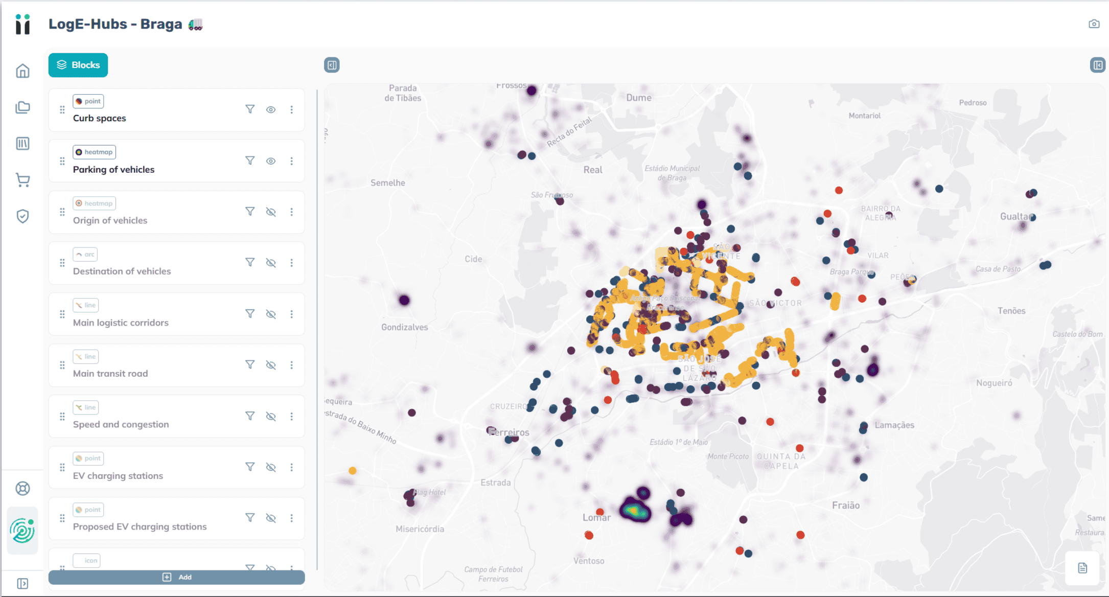
A platform at the service of decision-making


OUR CONTRIBUTION
URBAN RADAR, TECHNOLOGICAL PARTNER
Urban Radar is developing the LogE-Hubs platform to help local authorities plan their logistics infrastructure and optimise last-mile operations. By combining territorial data, logistics flows and mobility information, the solution makes it possible to identify the most relevant locations for urban hubs and support planning decisions.
MAPPING THE LOGISTICS ECOSYSTEM
Centralisation of data relating to warehouses, pick-up points, loading zones and existing infrastructure to provide a global view of the urban logistics ecosystem
ANALYSE LAST-MILE FLOWS
Exploiting traffic data, sensors and logistical flows to understand delivery dynamics and identify areas of congestion or pressure on public spaces
IDENTIFY THE OPTIMAL LOCATIONS
Multi-criteria analysis to assess the relevance of new logistics hubs based on their accessibility, proximity to economic activities, and connection to transport networks
SUPPORTING URBAN PLANNING
Provision of decision-support tools allowing local authorities to compare different spatial planning scenarios and to build more sustainable logistics strategies
The PROJECT



WITH THE SUPPORT OF

Let us go further together
Discover how the platform adapts to your context